Facts & Statistics
BY THE NUMBERS: VEHICLE FINANCING AND PERSONAL LENDING IN WASHINGTON
| STATE STATISTICS | |
| Population 2023 | 7,812,880 |
| Population 2022 |
7,785,786 |
| Population 2021 | 7,740,745 |
| Population 2020 |
7,693,612 |
| Population 2019 | 7,614,024 |
| Population 2018 |
7,535,591 |
| Population 2017 | 7,425,432 |
| Population 2016 | 7,294,680 |
| Below Poverty 2022 | 10 |
| Below Poverty 2021 | 9.9 |
| Below Poverty 2020 | 10.2 |
| Below Poverty 2019 | 9.8 |
| Below Poverty 2018 | 8.6 |
| Below Poverty 2017 | 11 |
| Below Poverty 2016 | 11.3 |
| Employment – Population Ratio 2022 |
61.1 |
| Employment – Population Ratio 2021 | 59.2 |
| Employment – Population Ratio 2020 | 62.9 |
| Employment – Population Ratio 2019 | 62.3 |
| Employment – Population Ratio 2018 |
61 |
| Employment – Population Ratio 2017 | 60.7 |
| Employment – Population Ratio 2016 | 60.2 |
| Unemployed 2022 | 4.4 |
| Unemployed 2021 | 6.1 |
| Unemployed 2020 | 7.1 |
| Unemployed 2019 | 4.5 |
| Unemployed 2018 | 4.5 |
| Unemployed 2017 | 4.7 |
| Unemployed 2016 | 5.3 |
| Foreclosure Rate 2024 | 1 in 4,222 |
| Foreclosure Rate 2021 | 1 in 2,400 |
| Foreclosure Rate 2018 | 1 of 3,356 |
| Median Household Income 2021 | 87,648 |
| Median Individual Income 2022 | 74,398 |
| High School Graduation Rate 2022 | 82.3 |
| High School Graduation Rate 2021 | 82.5 |
| High School Graduation Rate 2020 | 82.9 |
| High School Graduation Rate 2019 | 80.9 |
| High School Graduation Rate 2018 | 80.9 |
| Median Mortgage Payment 2021 | 2,110 |
| GDP 2023 | 672.13 Billion |
| GDP 2022 | 641.14 Billion |
| GDP 2021 | 630.82 Billion |
| GDP 2020 | 590.40 Billion |
| GDP 2019 | 588.93 Billion |
| GDP 2018 | 561.79 Billion |
| STATE FACTS |
|---|
| The Northwestern most point in the contiguous U.S. is Cape Flattery on Washington’s Olympic Peninsula. |
| The highest point in Washington is Mount Rainier. It was named after Peter Rainier, a British soldier who fought against the Americans in the Revolutionary War. |
| Starbucks was founded in Seattle. |
Government
| ELECTED OFFICIALS | |
| Governor |
Bob Ferguson (D) |
| Lieutenant Governor | Denny Heck (D) |
| Attorney General | Nicholas Brown (D) |
| Secretary of State | Steve Hobbs (R) |
| State Senate Control | D – 29; R – 19; Vacant – 1 |
| State House Control | D – 59; R – 39 |
Legislative Process
| LEGISLATIVE DATES AND DEADLINES | |
| Convenes | January 13, 2025 |
| Sine Die Adjournment | April 27, 2025 |
| Committee Action Deadlines | February 28, 2025 |
| Crossover Deadline | March 12, 2025 |
| Carryover from Previous Session | No |
| Governor’s Signing Deadline (in session) | Five days, Sundays excepted |
| Governor’s Signing Deadline (after adjournment) | 20 days from adjournment, Sundays excepted |
| Veto Override | 2/3 majority |
| Legislation Effective Date | 90 days following adjournment |
Notable Laws & Legislation
SAFE Act
- WA HB 1621 (Wash. Rev. Code Title 31, c. 31.04)
- WA HB 1749 (now Wash. Rev. Code Title 19, c.19.146)
- HUD review of Washington’s SAFE Act
Security Breach Notification Law
Retail Installment Sales Contract Law
AFSA Comment Letters
- Washington SB 6281 Joint Letter – Washington Privacy Act (March 11, 2020)
AFSA Testimony
- Washington SB 5070 – Interchange (January 17, 2025)
Enforcement
No Recent AG Enforcement
Consumer Complaints
Consumer Complaints
- Washington – Top Consumer Complaints (continually updated)
- Washington – 2015 Top Consumer Complaints
Regulatory Actions
Featured Regulations
- No Featured Regulations
Regulatory Guidelines
- WA Department of Financial Institutions Mortgage Industry Update (May 2016)
- WA Department of Financial Institutions Consumer Services – Summer 2016 Newsletter
- WA Department of Financial Institutions Consumer Loan and Mortgage Brokers Information Security Requirements
- WA Department of Financial Institutions Preventing Mortgage Servicing Complaints
- WA Department of Financial Institutions Responding to Consumer Complaints
- WA Department of Financial Institutions Information Security Resource List
Advocacy, Initiatives & Reports
Advocacy
- 33 States Amicus Brief re: Telephone Consumer Protection Act (March 2020)
- 23 State & DC Letter to FDIC re: “Rent-A-Bank” Predatory Lending (February 2020)
- 25 State & DC Letter to Education Department re: Student Loan Debt Relief (February 2020)
- 23 State & DC Amicus Brief re: Constitutionality of CFPB (January 2020)
- 21 State & DC Letter to OCC re: “Rent-A-Bank” Predatory Lending (January 2020)
- 19 State & DC Letter to Congress re: Education Department Borrower Defense Rule (January 2020)
- 20 State & DC Amicus Brief re: Public Student Loan Forgiveness (November 2019)
- 22 State Letter to Education Department re: Student Loan Forgiveness (November 2019)
- 21 State & DC Letter to HUD re: Housing Discrimination (October 2019)
- 29 State & DC Letter to Education Department re: Student Loan Fraud (October 2019)
- 20 State & DC Letter to Congress re: Cannabis Banking (September 2019)
- 27 State & DC Letter to CFPB re: Debt Collection Rule (September 2019)
- 31 States & DC Amicus Brief re: Student Loans (August 2019)
- 11 States & DC Letter to Education Department re: Public Service Loan Forgiveness Program (August 2019)
- 50 States & DC Letter to FCC re: Robocalls (August 2019)
- 24 States & DC Letter to CFPB re: Overdraft Rule (July 2019)
- 40 States & DC Letter to FTC re: Data Privacy (June 2019)
- 50 States & DC Letter to Education Department re: Student Loans for Disabled Veterans (May 2019)
- 24 States & DC Letter to CFPB re: Payday Rule (May 2019)
- 33 States & DC Letter to Congress re: Marijuana Banking (May 2019)
- 41 States & DC Letter to FCC re: Robocalls (May 2019)
- 20 States & DC letter to Education Department re: Student Loan Disclosure to Law Enforcement (April 2019)
- 24 State & DC Letter to CFPB re: Payday Lending Rule (March 2019)
- 50 States & DC Letter to U.S. Senate Committee on Commerce, Science & Transportation re: Robocalls (March 2019)
- 30 States & DC Letter to FTC re: Identity Theft Rule (February 2019)
- 22 State AGs Letter to CFPB re: Regulatory Sandbox (February 2019)
- 43 State AGs Letter to Social Security Administration re: Identity Fraud (December 2018)
- 33 State AGs letter to CFPB re: Military Lending Act (October 2018)
- 17 State AGs letter to HUD re: Affirmatively Furthering Fair Housing rule (October 2018)
- 8 State AGs Amicus Brief re: Student Loan Debt Relief (October 2018)
- 12 State AGs letter to CFPB re: proposed revisions to disclosure sandbox program (October 2018)
- 35 State AGs Letter to Federal Communications Commission (FCC) re: Robocalls (October 2018)
- 11 State AGs letter to Department of Education re: Public Service Loan Forgiveness (PSLF) Program (October 2018)
- 17 State AGs letter urging HUD not to undermine the Agency’s Fair Housing Act (FHA) disparate impact regulations (August 2018)
- 20 State AGs letter urging Secretary of Education to share student loan information with law enforcement (July 2018)
- 20 State AGs letter to Congress opposing valid-when-made legislation (June 2018)
- 14 State AGs letter urging CFPB to retain public database of consumer complaints (June 2018)
- 16 State AGs letter urging the Trump Administration to respect the CFPB’s investigative authority (April 2018)
- 20 State AGs letter to Congress regarding proposed FDCPA amendments (April 2018)
- 32 AGs letter urging Congress to preserve state’s authority to enforce data breach & security laws (March 2018)
- 30 AGs letter to Congress urging it to reject legislation that would block state oversight of student loan servicing industry (March 2018)
- 20 State AGs letter to Education Secretary re student borrower defense proposal (March 2018)
- 16 State & DC AGs brief calling on Trump Admin. to respect CFPB independence (February 2018)
- 18 State AGs urge Congress to incorporate cannabis industry into banking system (January 2018)
- 16 State AGs letter to President re CFPB (December 2017)
- Lawsuit opposing temporary CFPB director (December 2017)
- 36 State AGs Letter – Credit Freeze Fees (October 2017)
- 43 State AGs Letter – Major Data Breach (September 2017)
- 18 States Letter to CFPB – Proposed Arbitration Rule (August 2016)
- 9 State AGs & DC Joint Letter to Financial Corporation CEOs – Chip and PIN Technology (November 2015)
- WA AG Calls for Enhanced Data Security Law as Part of 2015 Legislative Agenda (January 2015)
- 31 State AGs Letter to CFPB – Debt Collection Rules (March 2014)
Trade Associations


Political Geography

(Click to Enlarge)
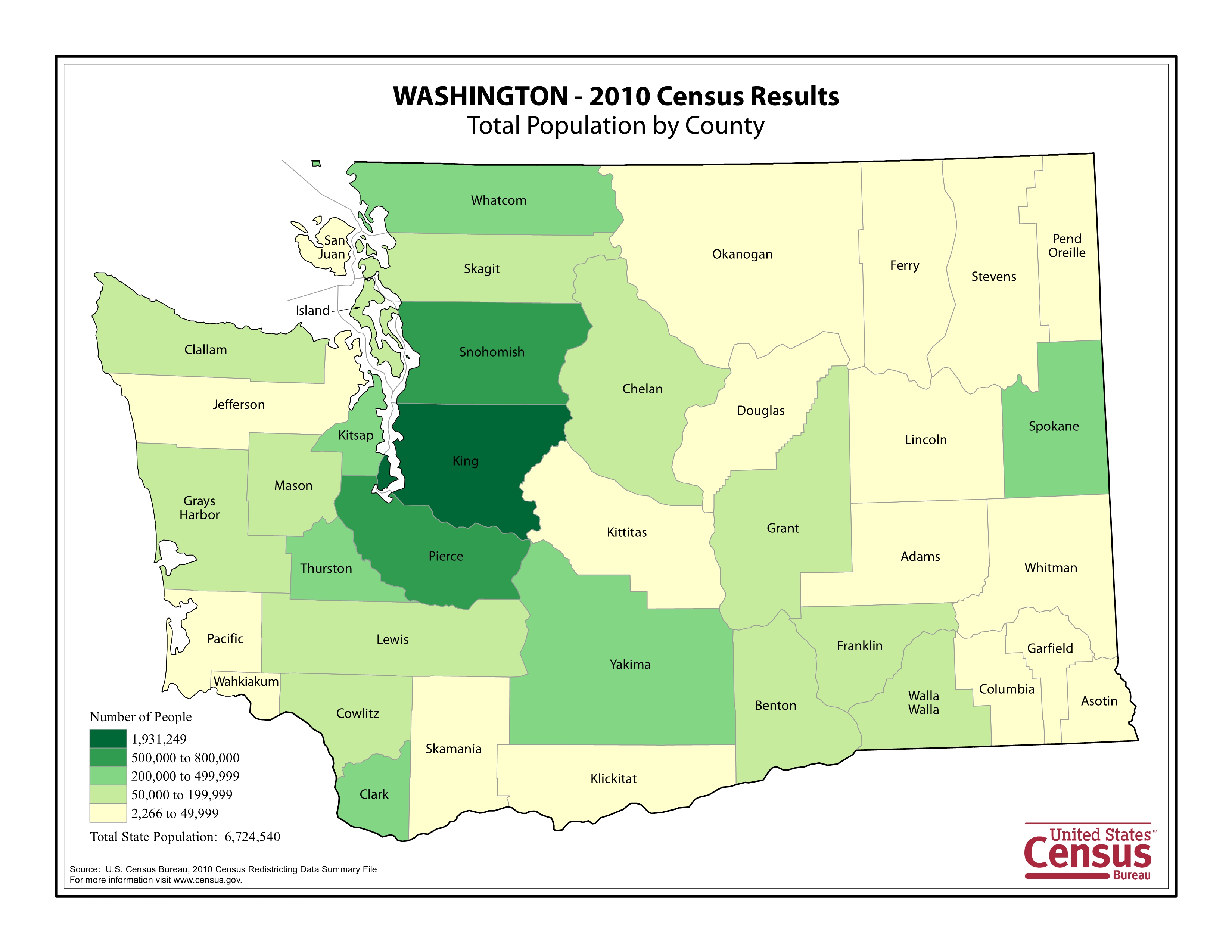
(Click to Enlarge)