Facts & Statistics
BY THE NUMBERS: VEHICLE FINANCING AND PERSONAL LENDING IN INDIANA
| STATE STATISTICS | |
| Population 2023 | 6,862,199 |
| Population 2022 |
6,833,037 |
| Population 2021 | 6,605,985 |
| Population 2020 |
6,754,953 |
| Population 2019 | 6,731,010 |
| Population 2018 |
6,691,878 |
| Population 2017 | 6,660,082 |
| Population 2016 | 6,633,344 |
| Below Poverty 2022 | 12.6 |
| Below Poverty 2021 | 12.2 |
| Below Poverty 2020 | 12.9 |
| Below Poverty 2019 | 11.9 |
| Below Poverty 2018 | 11.6 |
| Below Poverty 2017 | 13.5 |
| Below Poverty 2016 | 14.1 |
| Employment – Population Ratio 2022 |
61.9 |
| Employment – Population Ratio 2021 | 62.9 |
| Employment – Population Ratio 2020 | 64.3 |
| Employment – Population Ratio 2019 | 62.4 |
| Employment – Population Ratio 2018 |
62.7 |
| Employment – Population Ratio 2017 | 62.2 |
| Employment – Population Ratio 2016 | 61.8 |
| Unemployed 2022 | 2.4 |
| Unemployed 2021 | 4.5 |
| Unemployed 2020 | 4.3 |
| Unemployed 2019 | 3.5 |
| Unemployed 2018 | 3.4 |
| Unemployed 2017 | 3.6 |
| Unemployed 2016 | 4.4 |
| Foreclosure Rate 2024 | 1 in 987 |
| Foreclosure Rate 2021 | 1 in 606 |
| Foreclosure Rate 2018 | 1 of 2,241 |
| Median Household Income 2021 | 61,944 |
| Median Individual Income 2022 | 54,785 |
| High School Graduation Rate 2022 | 86.61 |
| High School Graduation Rate 2021 | 86.69 |
| High School Graduation Rate 2020 | 87.69 |
| High School Graduation Rate 2019 | 87.29 |
| High School Graduation Rate 2018 | 88.1 |
| Median Mortgage Payment 2021 | 1,195 |
| GSP 2023 | 401.47 Billion |
| GDP 2022 | 352.96 Billion |
| GDP 2021 | 337.9 Billion |
| GDP 2020 | 327.28 Billion |
| GDP 2019 | 337.9 Billion |
| GDP 2018 | 363.33 Billion |
| STATE FACTS |
|---|
| Indiana’s shoreline with Lake Michigan is only 40 miles long, but Indiana is still considered a Great Lakes State. |
| More than 100 species of trees are native to Indiana. Before the pioneers arrived, more than 80% of Indiana was covered with forest. Now only 17% of the state is considered forested. |
| The first professional baseball game was played in Fort Wayne on May 4, 1871. |
Government
| ELECTED OFFICIALS | |
| Governor |
Mike Braun (R) |
| Lieutenant Governor | Micah Beckwith (R) |
| Attorney General | Todd Rokita (R) |
| Secretary of State | Diego Morales (R) |
| State Senate Control | R – 40; D – 10 |
| State House Control | R – 70; D – 30 |
Legislative Process
| LEGISLATIVE DATES AND DEADLINES | |
| Convenes | January 8, 2025 |
| Sine Die Adjournment | April 24, 2025 |
| Committee Action Deadlines | N/A |
| Crossover Deadline | February 20, 2025 |
| Carryover from Previous Session | No |
| Governor’s Signing Deadline (in session) | Seven days |
| Governor’s Signing Deadline (after adjournment) | Seven days |
| Veto Override | Simple majority |
| Legislation Effective Date | July 1 following adjournment |
Notable Laws & Legislation
SAFE Act
- IN HB 1646 (now Ind. Code. Title 23, Art. 19, cc. 4, 5, and 6)
- HUD review of Indiana’s SAFE Act
Security Breach Notification Law
- Ind. Code §§ 4-1-11 et seq., 24-4.9 et seq.
AFSA Comment Letters
- Indiana Attorney General Proposed Rules – Security Breach (October 30, 2020)
Enforcement
No Recent Enforcement
Consumer Complaints
Regulatory Actions
Featured Regulations
- No Featured Regulations
Regulatory Guidelines
- No Regulatory Guidelines
Advocacy, Initiatives & Reports
Advocacy
- 33 States Amicus Brief re: Telephone Consumer Protection Act (March 2020)
- 11 State Amicus Brief re: Constitutionality of the CFPB (November 2019)
- 31 States & DC Amicus Brief re: Student Loans (August 2019)
- 50 States & DC Letter to FCC re: Robocalls (August 2019)
- 12 States Amicus Brief re: Constitutionality of CFPB (July 2019)
- 40 States & DC Letter to FTC re: Data Privacy (June 2019)
- 50 States & DC Letter to Education Department re: Student Loans for Disabled Veterans (May 2019)
- 12 States Letter to CFPB re: Payday Rule (May 2019)
- 41 States & DC Letter to FCC re: Robocalls (May 2019)
- 50 States & DC Letter to U.S. Senate Committee on Commerce, Science & Transportation re: Robocalls (March 2019)
- 15 State AGs Amicus Brief re: Tribal Immunity for Payday Lending (December 2018)
- 43 State AGs Letter to Social Security Administration re: Identity Fraud (December 2018)
- 35 State AGs Letter to Federal Communications Commission (FCC) re: Robocalls (October 2018)
- 16 State AGs Amicus Brief re: States’ Oversight on Student Lending Servicers (September 2018)
- 14 State AGs brief challenging the constitutionality of the CFPB (July 2018)
- 14 State AGs and 3 Governors letter urging President to extend regulatory oversight to independent agencies (December 2017)
- IN AG Proposes SB 413 – Data Security (February 2015)
- 31 State AGs Letter to CFPB – Debt Collection Rules (March 2014)


Political Geography
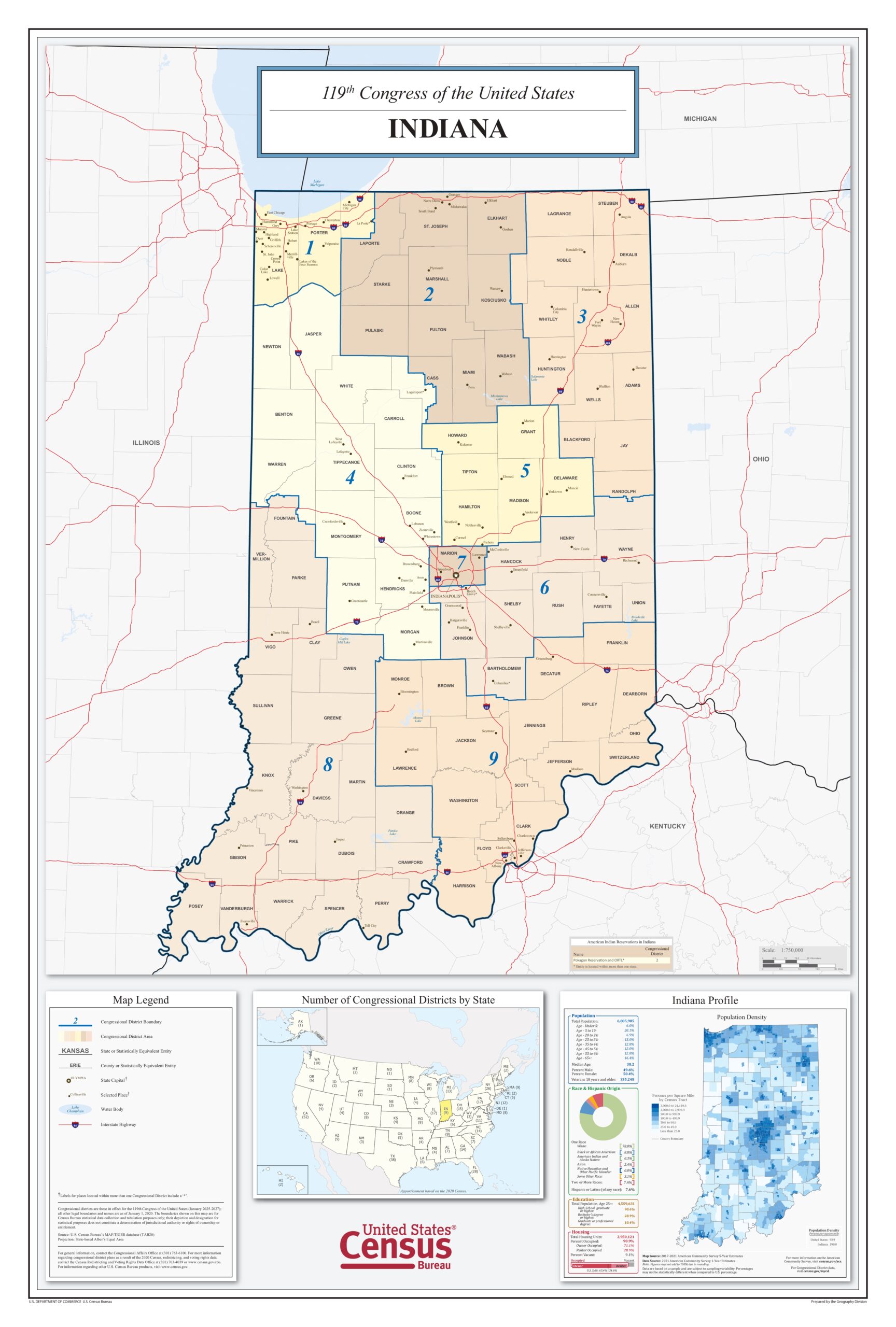
(Click to Enlarge)
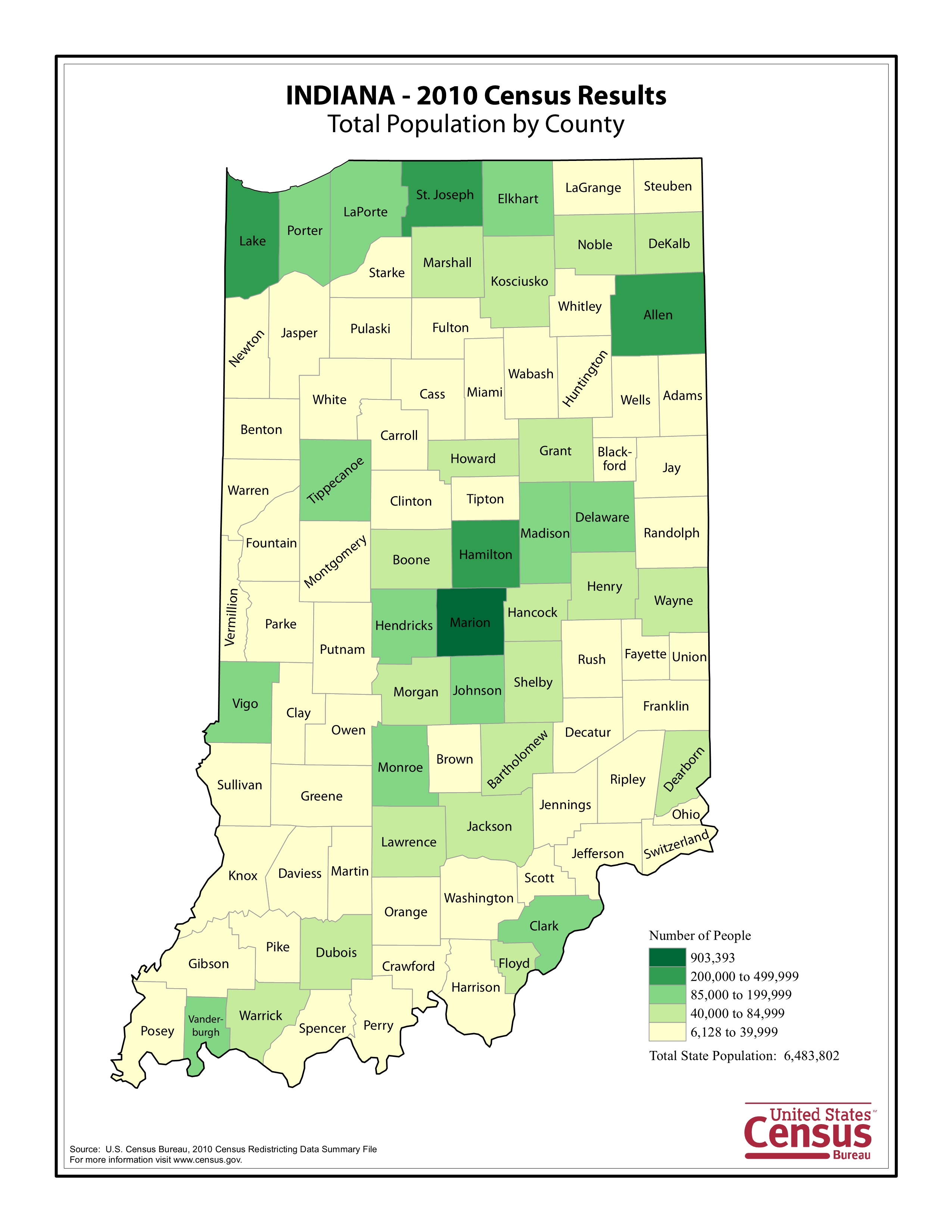
(Click to Enlarge)